views
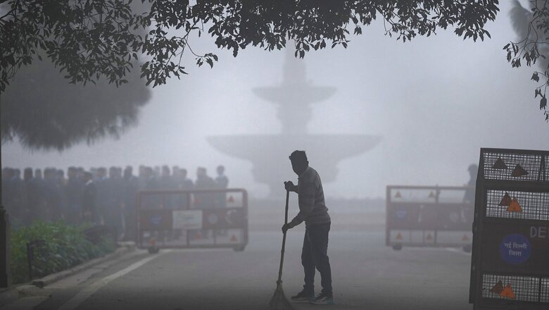
The dense fog blanketing most of north-west India could start lifting off during the next few days. The India Meteorological Department (IMD) says winds are picking up which could disperse the fog and pave the way for clear skies as the region welcomes the New Year.
North India remains under the grip of an intense cold wave with temperatures hovering between 3-7℃ over most parts of Punjab, Haryana, Delhi, Uttar Pradesh as well as parts of Madhya Pradesh.
The national capital recorded the season’s lowest temperature of 4℃ on Monday, with foggy conditions prevailing over most parts. The dense fog that has descended on the region has cut down the visibility levels to as little as 50 metres in parts of west Uttar Pradesh and less than 500 metres in most of Punjab, Haryana and Delhi delaying flights and trains.
WHY IS IT SO FOGGY?
Fog is common at this time of the year. Most of the water in the atmosphere lies in the lowest layer – troposphere. So when temperatures drop during winters, this water vapour condenses in less time, forming these tiny liquid droplets that hang in the air – reducing visibility. It is exactly how clouds form, but this time, much closer to the ground.
But in both cases, there has to be moisture or humidity in the air. This is why it becomes extremely foggy in winters, especially the day after it rains when the ground is damp.
While most of North India has mostly been dry this December, there is still high moisture in the lowermost layer of atmosphere. The winds are slow, making it perfect for the fog to roll in. Now if the day is slightly warmer than usual or it is sunny, then there are chances a dense fog will roll in by evening, because warmer air tends to hold more moisture, so more condensation.
According to IMD’s latest forecast, the dense fog could start losing its intensity and spread after the next two days as winds gather pace across most part of north-west India; except for Punjab, where the fog will continue to thicken over the subsequent days as well.
However, there could still be moderate fog during early morning and late evening hours.
COLD DAY/COLD WAVE ALERT
North India has been under the grip of a severe cold wave for over a week now, with night temperatures falling nearly 3-5℃ below normal. Haryana recorded its lowest temperature of 1.2℃ in Hisar, while it was 3.6℃ in Bathinda, Punjab. Fatehpur in Rajasthan recorded the lowest minimum temperature over the northwest plains at – 1.5℃.
The IMD has already sounded an alert for severe cold days continuing over several parts of the region. Unlike a cold wave which is formed when minimum temperatures fall 4.5℃ below normal for two consecutive days, a cold day is declared when the day temperature becomes below normal by over 4.5℃ and night temperatures remain under 10℃.
NO SNOWFALL ON NEW YEAR?
Despite sub-zero temperatures, the hill states of Himachal Pradesh and Uttarakhand are still awaiting the year-end snowfall as the entire month remains mostly dry. The lack of active western disturbances – systems that bring rain and snow during winters – is being prominently felt across the region this time. Shimla recorded the lowest temperature at 3.5℃ on Monday, while it was 11.9℃ during the day.
However, the forecasters have predicted scattered light rain in higher reaches of Jammu and Kashmir, Himachal Pradesh and Uttarakhand on December 29-30 due to a feeble western disturbance impacting the region. But the rest of the region is most likely expected to remain dry. There could be a slight increase in night temperatures after December 28, which may help in abating the cold wave.
Read all the Latest India News here


Comments
0 comment