views
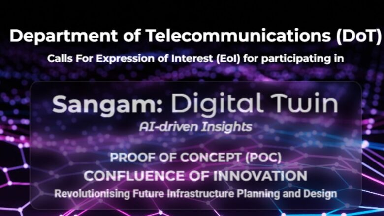
On February 15, the Indian government floated a game changing initiative involving cutting-edge technology and innovation to achieve an industrious goal: the 3D and interactive digital reproduction of physical assets such as urban landscapes or sensitive ecosystems. A host of potential stakeholders and contributors, including industry pioneers, startups, MSMEs, academia, innovators and forward-thinkers, have been invited for expression of interest (EOI).
The government’s push for Digital Twin technology is meant to pave the way for creation of virtual replicas of physical assets, allowing real-time monitoring, simulation and analysis facilitating iterative experimentation and feedback loops to effectively adapt to changes and optimise outcomes.
The government has invited engagement from diverse stakeholders to transform infrastructure planning through the utilisation of cutting-edge technologies such as 5G networks, Internet of Things (IoT), Augmented Reality/Virtual Reality (AR/VR), Artificial Intelligence (AI), and AI-native Sixth Generation (6G) networks, and Digital Twin. According to a notification from the Ministry of Communications, Sangam appeals to the “collective intelligence of public entities, infrastructure planners, tech giants, startups, and academia to break the silos and engage in a whole-of-nation approach”.
In accordance with the objectives outlined in the national geospatial policy, the aim is to develop ‘Digital Twins’ for the prominent cities and towns across the country by the year 2035.
WHAT IS DIGITAL TWIN TECHNOLOGY?
Digital twin technology entails generating virtual duplicates or simulations of tangible objects, systems, or procedures. These digital replicas are linked to their real-world equivalents via sensors and data flows, facilitating instantaneous monitoring, analysis and enhancement.
For example, Google Maps is a digital twin of the transportation system with all possible paths between destinations and current information on road status such as inputs on traffic.
All cities have their own problems— congested roads and challenges to traffic management, unplanned urban growth, large infrastructure planning, unoptimised spaces, poor resource management, unsustainable growth and so on, are some of the examples. In a developing country like India, and even in the developed world, there is little room for error as cities get bigger, and the stakes grow higher.
Governments around the world are investing in this digital mirroring technology with Dubai, Shanghai, New York, Singapore, Helsinki and a few others having their digital twins built. With little to lose, India seeks to start early in this realm.
PUTTING FUTURISTIC TECH TO THE TEST
The Indian government’s initiative seeks to put the futuristic technology of ‘Digital Twin’ to the test while leveraging the latest cellular network technology, the power of interconnected tech systems, the evolving world of virtual reality, artificial intelligence and more.
In its current form, the Sangam: The Digital Twin initiative is a proof of concept (PoC) divided into two stages, to be implemented in one of India’s major cities. The first stage focuses on exploratory activities to gain clarity on the project’s scope and foster creative exploration to unlock its potential. The second stage involves the practical demonstration of specific use cases, aimed at creating a future blueprint that can serve as a roadmap for scaling and replicating successful strategies in future infrastructure projects through collaborative efforts.
Building on the progress made over the past decade in communication, computation and sensing technologies, the initiative is poised to propel forward within the ‘techade’, with a visionary outlook extending to 2047. India’s landscape has been marked by significant strides in computational technologies, diverse platforms, innovative services, and the widespread availability of high-speed connectivity, laying a robust foundation for future endeavors.
Sangam aims to convene all stakeholders on a single platform to convert innovative ideas into tangible solutions, bridging the gap between concept and realization. It advocates for a holistic approach to innovation, encouraging stakeholders to transcend traditional boundaries and harness unified data and collective intelligence.
Aligned with global movements towards smart infrastructure and bolstered by India’s geospatial advancements, Sangam aims to position India as a leader in digital infrastructure and innovation, while acknowledging similar progress made by global counterparts. It calls for the creation of an ecosystem that maximises the value of technological advancements to meet societal needs for efficient, effective, and sustainable development.
Through this initiative, the government seeks to demonstrate practical implementation of innovative infrastructure planning solutions, develop a model framework for facilitating faster and more effective collaboration, and provide a future blueprint for scaling and replicating successful strategies in future infrastructure projects.
NATIONAL GEOSPATIAL POLICY
The National Geospatial Policy, introduced on December 28, 2022, is a crucial initiative aimed at advancing the geospatial sector to support national development, economic growth and the emergence of an information-rich economy. It is a visionary roadmap contributing to socio-economic progress, geared towards realising India’s ambition of becoming a five-trillion-dollar economy and achieving sustainable development goals.
Inspired by this policy, Genesys International, a prominent 3D mapping firm entered a strategic partnership with Survey of India (SOI), the nation’s primary surveying and mapping authority, on Wednesday (November 22). This alliance aims to innovate India’s maps by introducing the ‘3D Digital Twin Mapping Program,’ promising a transformative impact. So far, the company has produced digital twins of Ayodhya, the Dharavi slum cluster in Mumbai, Kochi and Kanpur, among other achievements.
Geospatial technology, an advanced tool for analysing location-based data, helps monitor natural resources, plan development, and respond to disasters. This technology provides a comprehensive view of Earth through satellite imagery, GPS, remote sensing, and GIS. The citizen-centric policy builds upon the momentum created by the 2021 guidelines for acquiring and producing geospatial data and services, fostering a more liberalised approach to geospatial data handling. It aims to provide a comprehensive framework for the sector’s development, focusing on nurturing infrastructure, skills, standards, and businesses.
The policy emphasises innovation and enhancing national and sub-national systems for managing geospatial information. Governed by existing guidelines, it encourages private sector involvement by improving the ease of doing business in the geospatial arena.
This policy has already registered several achievements and made a significant impact on the ground. The establishment of over 1,000 continuously operating reference stations across India, providing centimeter-level real-time positioning, stands as a notable achievement. These stations significantly elevate the quality of location-based services, supporting applications such as mapping, food delivery, navigation, and identifying optimal retail locations.
Furthermore, the development of numerous geospatial data-sharing portals represents another significant milestone. These platforms offer entrepreneurs access to open geospatial data and satellite imagery, fostering the creation of innovative applications beneficial to both citizens and governance. Additionally, substantial efforts in capacity building and skill development, led by academic institutions and specific government programmes, have been instrumental in advancing the geospatial sector.
The strides made in this sector of geospatial technology and India’s ambitious goals for the future in this realm, empower the country to invest in the concept of digital twin technology and seek innovative tech breakthroughs which could leapfrog the economy. This is where the ‘Sangam: Digital Twin’ programme could reap significant gains for India, optimising the country’s technological strides in the fields of internet connectivity, fintech, information technology etc., and ushering in an era of smart infrastructure.


Comments
0 comment