views
Getting Your Bearings
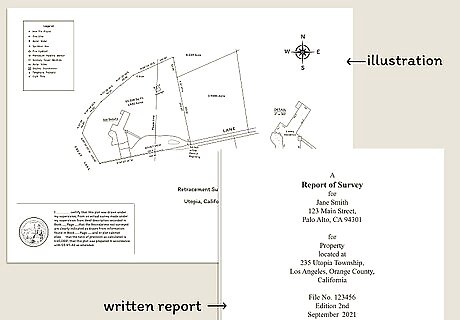
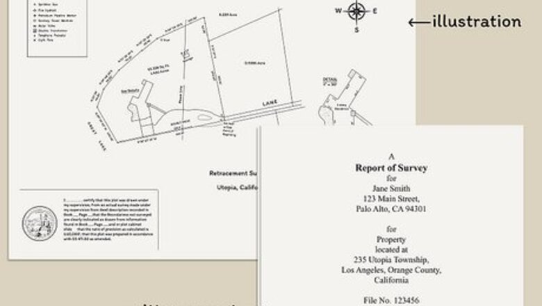
Identify the survey parts. The property survey consists of two parts: the illustration and the written report. The illustration is basically a map of the area surveyed. Place the survey illustration on a large flat surface, as property surveys can be quite large. Keep the written report on hand for easy reference.
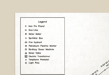
Familiarize yourself with the legend. The legend is usually set in the corner of a survey illustration. It contains icons which indicate important property attributes such as wells, borders, structures, or utility lines. If any elements of the legend are unclear or need explanation, contact your surveyor.
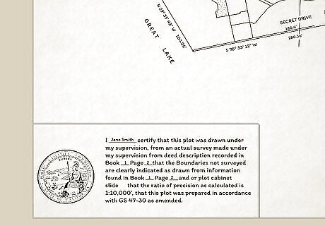
Locate the surveyor's certificate. The surveyor's certificate should be signed and dated with an embossed seal. This certificate provides a legal foundation for the survey's validity. If absent, the survey will not provide you with legal protection in a court of law.
Digging Into the Details
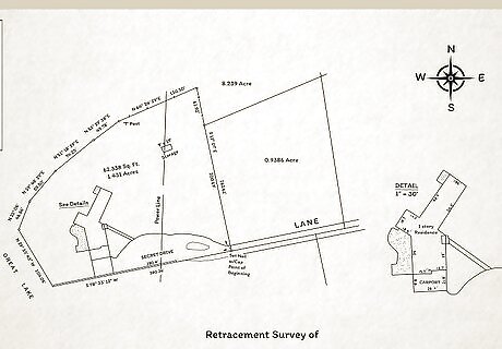
Orient yourself in the survey illustration. The illustration should include a compass indicating which way is north. This is often located near the legend, or separately in a corner of the illustration. A good survey will distinguish between magnetic north and astronomical north. If the survey does not distinguish between the two, it's probably based on magnetic north, but you should check with your surveyor to be sure.
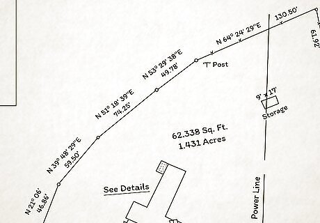
Understand the property boundaries. Property boundaries are denoted with both bearing and distance. The bearing is a series of degrees, minutes, and seconds with compass point letters before and after each element. The distance indicates how far from a given point a boundary line extends. The bearing represents the angle between north or south and east or west. You can measure this angle from a central point with a protractor. For instance, you might have a bearing of N 38° 03' 09" E. If you measured an angle of 38° 03' 09" from the north to the east on the survey illustration, you could then trace that northeasterly line to identify one of your property's boundaries. Degrees, minutes, and seconds are the units of measure for property survey bearings. For example, N 38° 03' 09" E would translate as 38 degrees, 3 minutes, 9 seconds from the north to the east. The boundary lines, or "legs," are often denoted in feet and listed directly below or after the bearing.
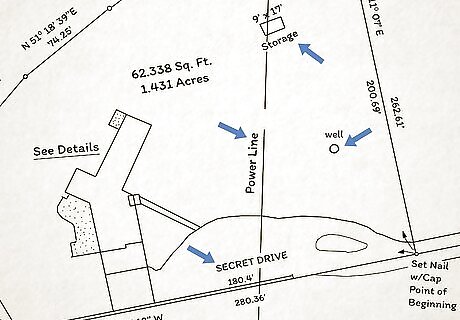
Find important features. The illustration and accompanying written report should include the following, where present: Physical and overlapping boundaries Water structures such as a lake or stream Shared fencing, driveways or sidewalks with a neighboring property Roadways or driveways that are nearby Existing property points of entry or egress Buildings, repairs, modifications or structural improvements on the property Locations of utilities, including water pipes and other plumbing, electrical, cable and/or telephone lines, gas lines, and utility poles
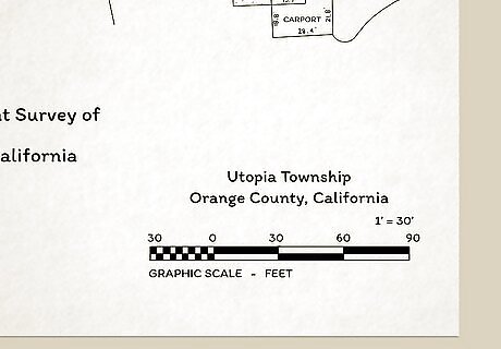
Note the scale and scope of the survey illustration. There should be a scale near the legend which indicates how distances are represented on the survey illustration. The scale will help you gauge distances on the property in question, including distances between it and nearby landmarks. For instance, one inch might correspond to one mile on the land survey illustration. The illustration might also orient the reader by providing a vicinity map -- also called a location map -- to indicate where the property lies in relation to the larger locality. The vicinity map is a small square inset usually located in a corner of the survey illustration.
Putting the Survey In Context
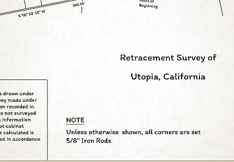
Read the notes. Notes are found on the survey illustration and provide information pertaining to former ownership of the land being surveyed or nearby properties. A more thorough account of the property can be found in the written report.
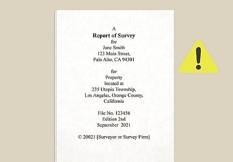
Read the written survey report carefully. The report includes legal information and additional comments provided by the surveyor. This document may also contain: Official property measurements. Any easements that may exist on the property. An easement allows a third party legal access to a property. For example, when you give your neighbor permission to park in your driveway or allow a utility company to run electrical lines run through your property. Any other property improvements that may have occurred since the latest survey on file. The report will also indicate if these improvements meet the code standards set up by the local building department. An indication as to whether the property is zoned for residential or commercial use.
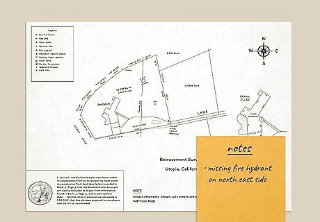
Write down any points of confusion or concern. It might be good to have a friend or family member read the property survey with you so that they can offer suggestions or identify potential issues you might have missed. After reading the survey, contact your surveyor to clear up any misunderstanding. Remember, understanding your survey is crucial for establishing full control over your property.
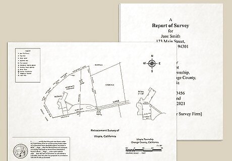
Put your survey to use. Whether you are buying a new property, looking to build on your land, or trying to sell some or all of your land, your property survey will help move the process along. If the boundaries of your property are ever in question, consult your property survey to settle the matter.


Comments
0 comment