views
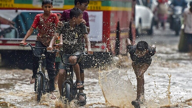
Mumbai: Mumbai saw incessant rains on Sunday and early on Monday with Santacruz recording the highest amount of rainfall at 195mm, followed by suburban Malad (west) which received 110.80 mm, an Indian Meteorological Department official said.
Among other areas, Colaba recorded 90mm rainfall, Powai 77.80 mm and Mulund (west) received 76 mm.
The IMD official explained, "Synoptic analysis indicates that the offshore trough at mean sea level runs from south Gujarat coast to Kerala coast. A cyclonic circulation lies over south Konkan and its neighbourhood and another cyclonic circulation lies over north Konkan and adjoining south Gujarat."
The official said that under the influence of these meteorological conditions, isolated heavy to very heavy rain over Konkan and Goa and isolated heavy rainfall over Gujarat region, central Maharashtra, Marathwada, coastal Karnataka and Kerala is very likely on Day 1, which was Sunday.
Mumbai is expected to receive ‘heavy’ to ‘very heavy’ rainfall on Monday.
India Meteorological Department (IMD) data has revealed that less than 25 percent of the country has received normal or excess rains till now, with the weatherman on Sunday saying that monsoon activity has revived over the weekend and is making a steady advance.
Central India and the north Indian plains, that have been witnessing a rise in temperatures, are likely to get some relief in the next two to three days, the meteorological department said.
Conditions are becoming favourable for pre-monsoon thunderstorm activity over parts of northwest India from June 27, IMD's Additional Director General Mritunjay Mohapatra said.
The monsoon is expected to hit Delhi on June 29, its normal onset date for the national capital.
After making an early arrival on May 29, three days ahead of its normal on-set date, the Southwest Monsoon battered the coastal parts of Kerala, Karnataka, Maharashtra and south Gujarat.
However, the overall monsoon deficiency till Saturday stood at minus 10 per cent.
Of the four meteorological divisions of the country, only the southern peninsula has recorded 29 per cent more rains. The rainfall deficit was 29 and 24 per cent in east-northeast and northwest India respectively.
Of the 36 meteorological sub-divisions in the country, 24 subdivisions have received "deficient" and "largely deficient rainfall". This means, less than 25 per cent of the country has received "normal" or "excess" rainfall.
"The monsoon has revived from June 23. It has today advanced to Gujarat's Saurashtra (region), Veraval, Ahemdabad, and Maharashtra's Amravati. On the eastern side, it has covered the entire Assam, reached Jalpaiguri in north West Bengal and Midnapore in south West Bengal. The North Indians plains will receive pre-monsoon thunder showers on June 27," Mohapatra said.
In the next 48 hours, the remaining parts of Odisha, West Bengal, some parts of Gujarat and Madhya Pradesh, remaining parts of Maharashtra, and east Uttar Pradesh will witness monsoon showers, he said.
(With PTI inputs)


Comments
0 comment