
Rescue and evacuation operations are on in Joshimath. The hilly town made news after a majority of buildings developed scary cracks. The government has declared the area as land subsidence-hit.
While there are many causes that contributed to the sinking of Joshimath, one less talked about is the role water played in the phenomena which has ultimately led to the current situation.
But to understand that, it’s essential to know that the soil in Joshimath has been described as ‘weak’, comprising mostly of debris brought about by landslides.
It is also a highly seismic zone.
Consider, a town built on such terrain, and not just that but accompanied by unplanned construction, population pressure, tourist infrastructure, and a whole lot of other factors we will talk about in detail in this report.
While the warning signs have been sounded from years ago, the area saw an increased amount of human construction and activities. But the problem did not lie as much in the infrastructural development, but in the unscientific nature it was carried out in, said experts.
What Role Does Water Have to Play in Joshimath’s Sinking?
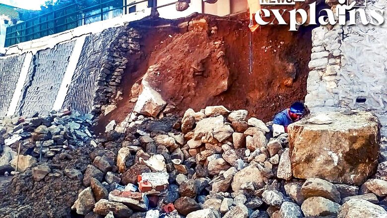
Experts say that Joshimath’s top soil is very unstable, and that the town was built on relatively loose soil deposited by landslides caused by earthquakes.
There are numerous loose soft rocks, moraine (material left by receding glaciers), and sediments, glaciologist D P Dobhal told the Indian Express, as the area was once covered by glaciers.
Meanwhile, the constructions have also been an impediment to natural water flows. And hydropower projects, and development activities have all contributed to the current situation.
Another way that water plays a role in this situation is the lack of systematic drainage that has exacerbated the situation.
Unregulated construction has frequently obstructed the natural flow of water, forcing it to seek alternate routes.
“A lot of water has been percolating down into the porous crystalline rocks beneath the surface, softening them even more. When water is not allowed to flow naturally, it creates a lot of pressure, either above or below ground. And this location already has a lot of subsurface pressures in the form of tectonic forces,” Kalachand Sain, director of the Dehradun-based Wadia Institute of Himalayan Geology told the Indian Express.
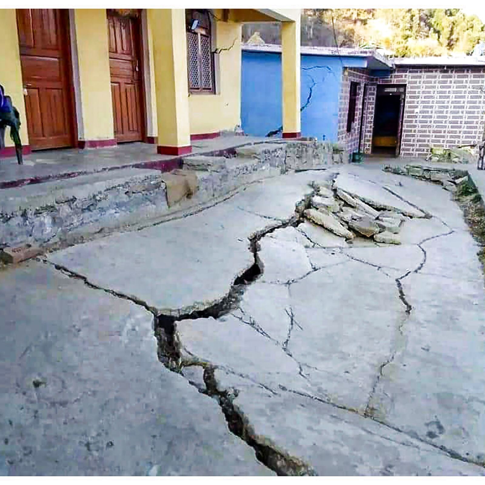
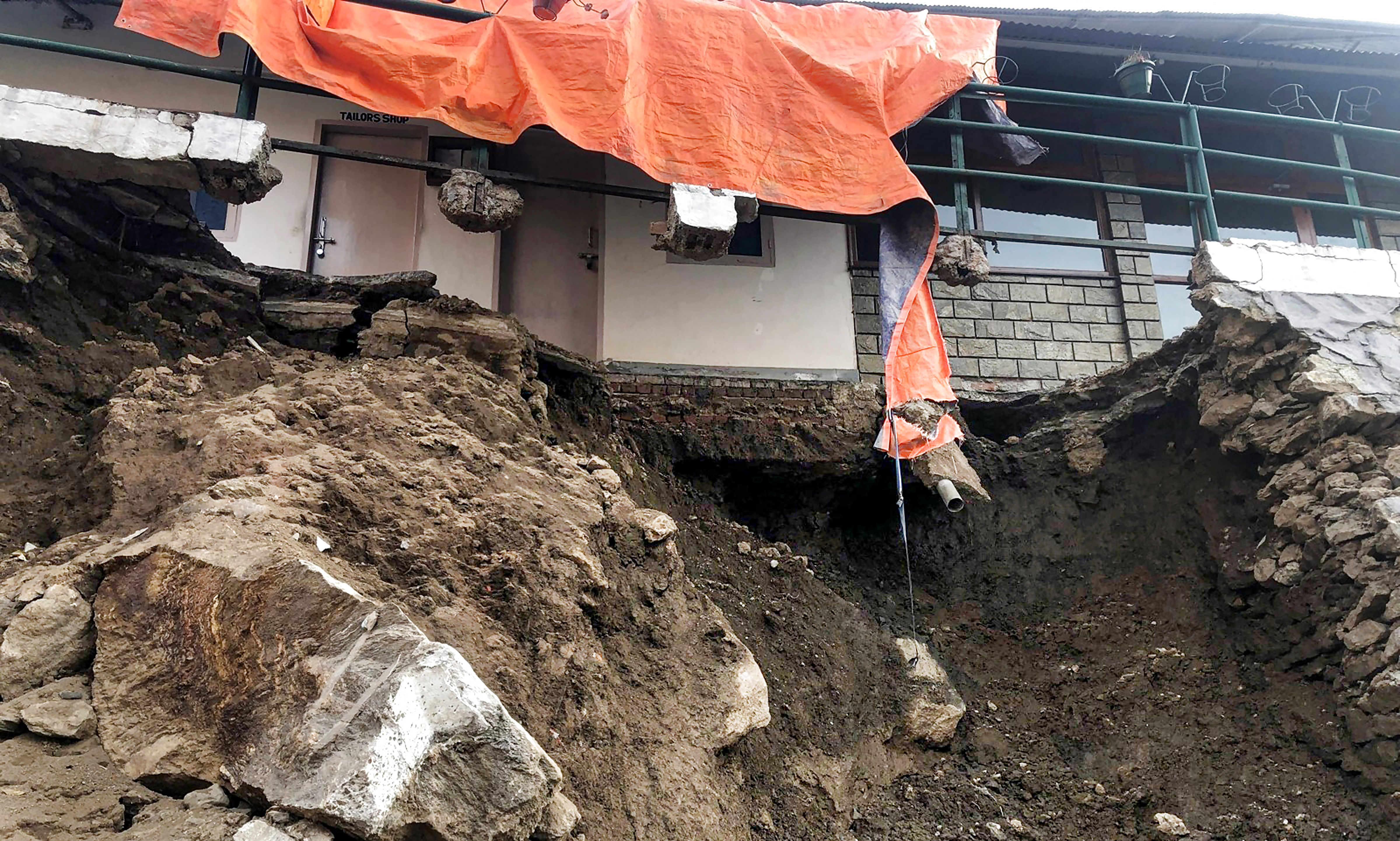
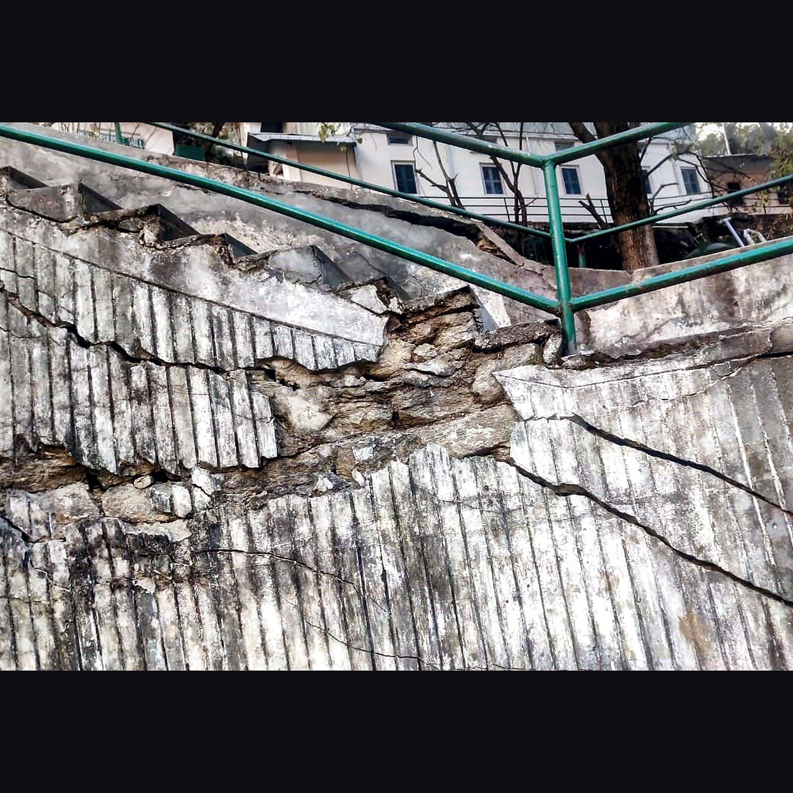
All of this has raised concerns that some parts of town may collapse under their own weight.
What Did Experts Tell News18 ?
According to experts, much of this water could have been seeping into the ground, weakening the already loose sediments in the subsurface. Water erupted from the ground in a Joshimath colony on the night of January 2, raising alarms.
Dr Swapnamita Choudhary of the Wadia Institute of Himalayan Geology identified such risks associated with the poorly planned drainage and sewage system in her 2006 report, emphasising the need for immediate attention.
The Border Roads Organisation (BRO) has been too harsh in its criticism of the drainage system, particularly during the monsoon season, when the situation in the nine naalas is out of control. In the absence of proper drains, rains cause mud flows, with a lot of water flowing over the roads. News18 found out that scientists who surveyed the area last year noted improper drainage management at every site they visited. Read more of this report here
‘Install Drainage Systems’
Since Thursday, a team has been surveying Joshimath to determine the extent of damage caused by land subsidence. Its members include Garhwal commissioner Sushil Kumar, disaster management secretary Ranjit Kumar Sinha, disaster management executive officer Piyush Rautela, National Disaster Response Force deputy commandant Rohitas Mishra, and IIT Roorkee landslide experts Shantanu Sarkar and BK Maheshwari, a report by Hindustan Times states.
Sinha stated that the National Institute of Hydrology will be tasked with investigating the water seepage in Joshimath and determining its source.
“We should also conduct a thorough investigation into the root causes of the sinking phenomenon,” he added. “A proper drainage and sewerage system should be in place to prevent water percolation.”
The main recommendations of an August study conducted by the Uttarakhand State Disaster Management Authority must be implemented, according to Rautela.
It has also been suggested that the rivulets of Ravigram, Nau Ganga, Kamad-Sema, Tehsil Chunar, and Kamet Marwari be lined with graded drainage systems with a stepwise gradient along the slope, roads be properly compacted and consolidated during construction to reduce subsidence, seepage from stormwater and household wastewater drains be minimised through routine maintenance and repairs, and foundation soil of houses showing continuous crack development be repaired.
Read all the Latest Explainers here


Comments
0 comment