views
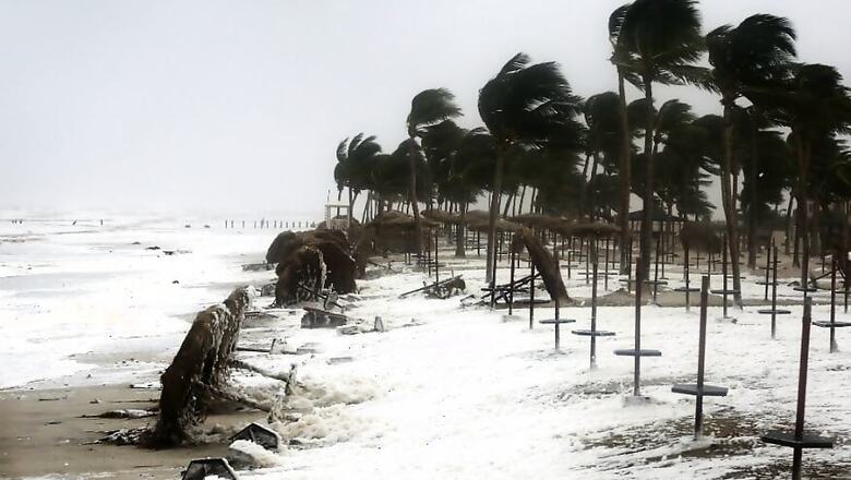
Chennai: Cyclonic storm 'Gaja' over the Bay of Bengal is set to make landfall between Cuddalore and Pamban on Thursday evening, bringing heavy rainfall to Tamil Nadu.
'Gaja' that lay over southwest and adjoining southeast and west central Bay of Bengal is about 550 km north east of Nagapattinam and is very likely to cross coast between Pamban and Cuddalore on Thursday evening or night with a wind speed up to 100 kmph, the Met office here said.
The Indian Navy was also put on high alert. Navy officials said the Eastern Naval Command (ENC) has assumed a high degree of readiness to render necessary humanitarian assistance as the cyclone is poised to cross the coast of the two states on Thursday evening.
“Two Indian Naval ships - Ranvir and Khanjar - are standing by to proceed to the most affected areas to undertake humanitarian aid and distress relief," said a Navy official. He said these ships will have additional divers, doctors, inflatable rubber boats, integral helicopters and relief material on board.
The official said helicopters, Dornier aircraft and one P8I aircraft are on standby to undertake reconnaissance, rescue and casualty evacuation.
With the Tamil Nadu government already declaring that 30,500 rescue personnel were on standby, the district collectors of Thanjavur, Tiruvarur, Pudukottai, Nagapattinam, Cuddalore and Ramanathapuram have declared holiday for schools and colleges on Thursday. All educational institutions in Puducherry and Karaikal regions would remain closed in view of the cyclone.
Against the backdrop of the Central Water Commission advising constant vigil over dams, Tamil Nadu Revenue Minister RB Udayakumar told reporters that dams, lakes and rivers channels were being monitored continuously. The CWC had advised action as per the Standard Operating Procedure as heavy rainfall in catchment areas could fill up the dams fast in less than 24 hours.
The minister said mobile operators have assured to move 'Cell on Wheels' mobile platforms to provide uninterrupted mobile connectivity to Nagapattinam and Cuddalore districts which are likely to witness the cyclone impact during landfall. The government has also held discussions with oil marketing companies and they have been advised to maintain sufficient fuel stock, he said.
While reiterating caution to fishermen to not venture into the sea, Udayakumar said a comprehensive list of do's and don'ts have been circulated to the people on cyclone eve. The red column in the Met bulletins only indicate that steps to mitigate possible disaster should be taken by the government which has already been done and people should not panic, he underlined.
The Met office had warned storm surge of about 1.0 metres likely to inundate low-lying areas of Nagapattinam, Thanjavur, Pudukkottai and Ramanathapuram districts of Tamil Nadu and Karaikal district of Puducherry at the time of landfall.
The IMD also cautioned about major damage to thatched huts. "Roof tops may blow off," and communication and power lines may be affected it had said adding standing crops could also be hit besides water intrusion in low lying areas.


Comments
0 comment