
These images captured by NASA's Aqua satellite show how the area looked like before the multi-day cloudburst and what it was after.
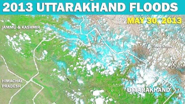
It has been a year since floods and landslides wreaked havoc in the hill state of Uttarakhand killing thousands. These images captured by the Moderate Resolution Imaging Spectroradiometer on NASA's Aqua satellite in May and June 2013 show how the area looked like before the multi-day cloudburst and what it was after. These false-colour images use a combination of visible and infrared light to make it easier to distinguish between water and land. Water appears blue and vegetation is bright green. Clouds are pale blue-green and cast shadows. Glacier ice and snow in the Himalayas are pale blue to cyan.
####


Comments
0 comment